Texas Parks and Wildlife’s Managed Lands Deer Program (MLDP) rewards land stewardship with extended hunting seasons and population specific tags. Through MLDP, enrolled landowners can hunt from early October through the end of February, which is significantly longer than the general season.
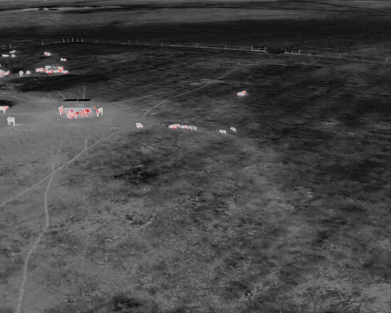
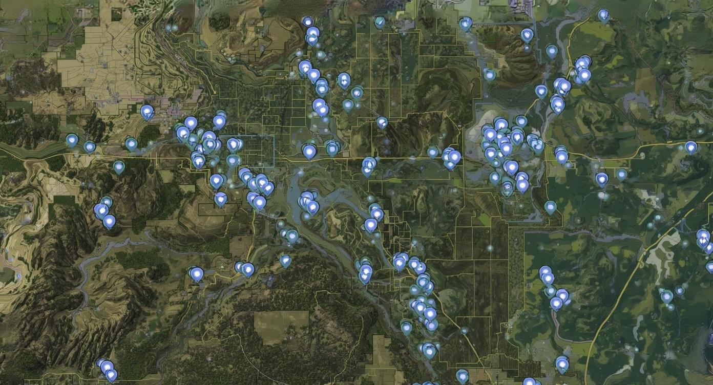
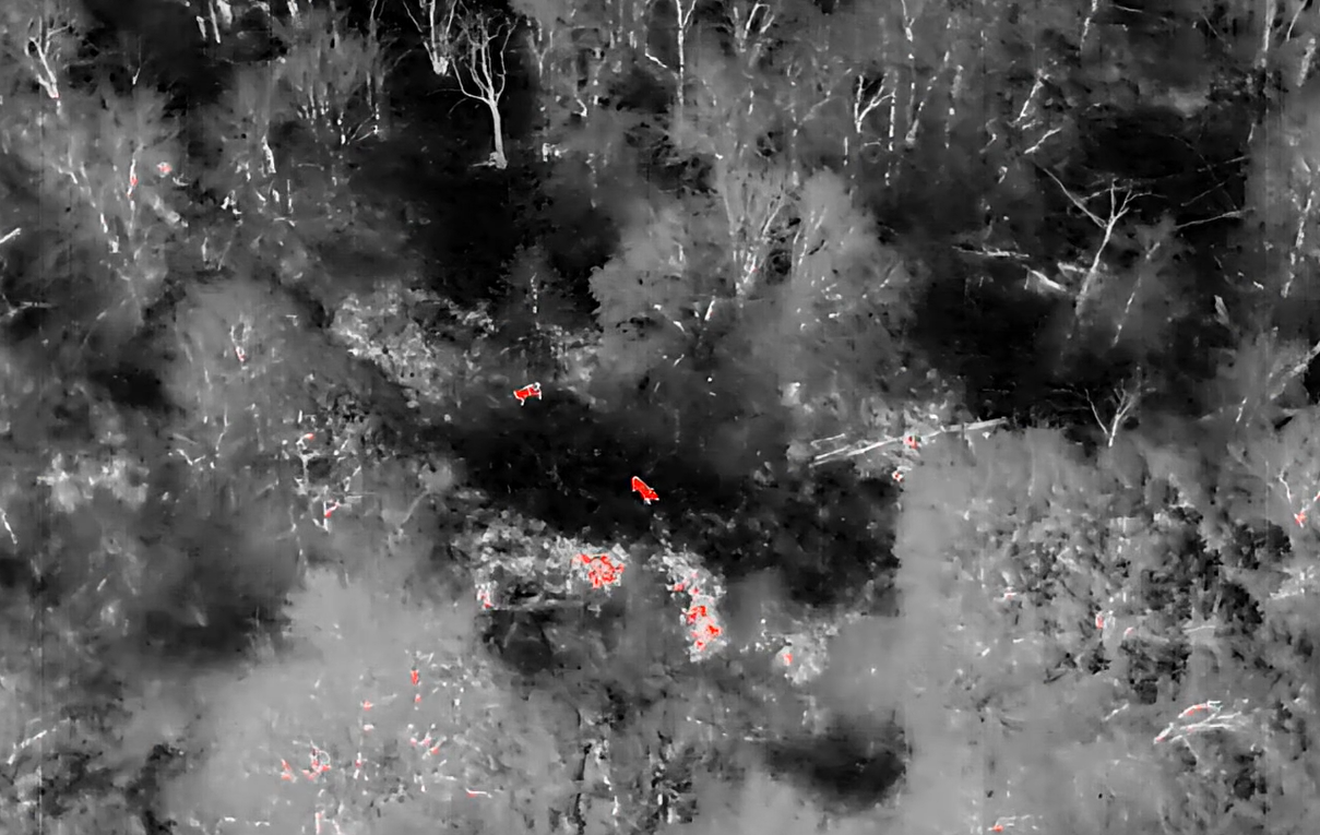
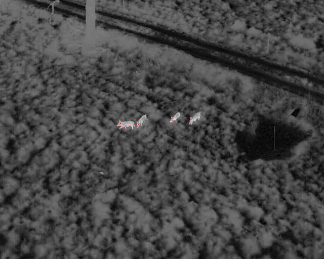
We provide the surveys and management intelligence needed to qualify for and succeed in MLDP. From accurate herd counts to habitat guidance, we help you submit your application, complete the required documentation, and navigate the enrollment process with confidence.
Once enrolled, we continue monitoring your progress. Combining advanced thermal surveys with ongoing support, we help you meet MLDP goals year after year, keeping your operation efficient and compliant.
• Precise herd counts tailored for TPWD biologist review
• Buck to doe ratios and wildlife data essential for harvest planning
• Assistance with MLDP applications and required documentation
• Habitat management recommendations based on survey insights
• Options for regular monitoring to keep your management plan on track
• Landowners seeking longer seasons and better herd control
• Outfitters managing harvest pressure and client satisfaction
• Ranches looking to boost habitat quality and long term herd health
• Conservation minded properties focused on strategic wildlife management
Strong wildlife programs don’t happen by chance. They’re built on good data and consistent effort. With Vantage Recon, you’re not just qualifying for MLDP, you’re building a lasting management system grounded in precision and trust.
Reach out today to begin your MLDP journey or add habitat support to your next survey.
We start with a quick call to understand your property and your goals. We take time to learn exactly what you want to accomplish so we can tailor the survey to your needs and deliver the most useful data possible.
Based on your acreage and objectives, we provide a clear estimate and prepare a custom flight plan. This includes survey routes, coverage areas, and the thermal and/or visible-camera requirements for your selected services.
We start with a quick call to understand your property and your goals. We take time to learn exactly what you want to accomplish so we can tailor the survey to your needs and deliver the most useful data possible.Once the flight plan is approved, we schedule your survey for the earliest ideal window—typically at dusk or nighttime when thermal signatures are most accurate. We coordinate access, gates, and all on-site logistics.
We arrive on-site, conduct the full thermal survey, capture all required footage and data, and ensure the entire property is fully and accurately surveyed according to the flight plan.
Within 7 days of the survey, you receive all deliverables included in your selected package. This may include:
– Herd count breakdown
– Wildlife intel map
– Highlight reel
– Habitat notes or MLDP support