Take the Guesswork Out of Wildlife Management
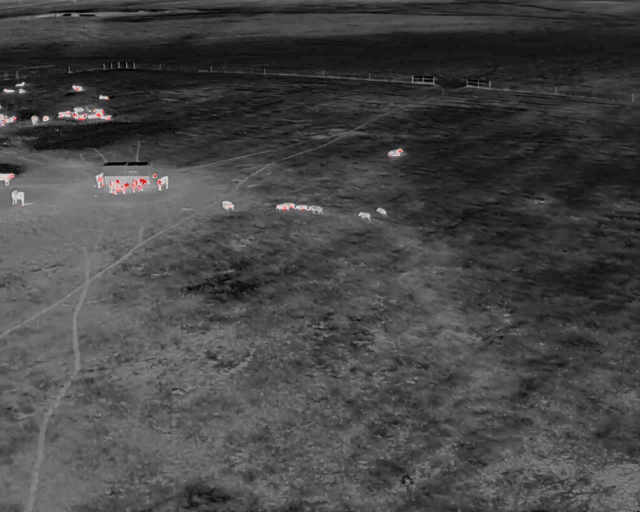
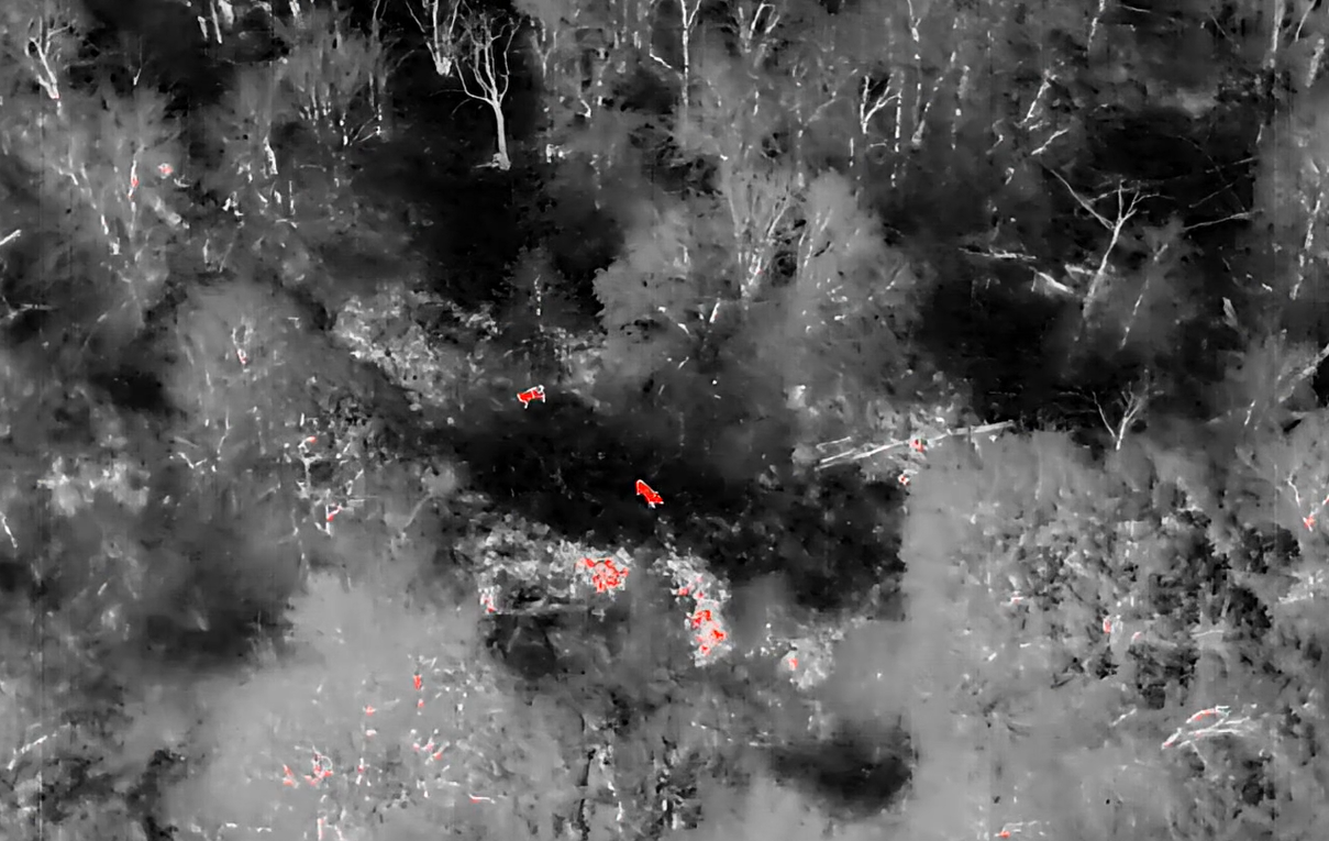
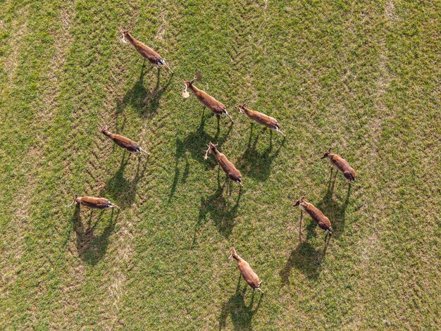
Every property tells a story, but without the right tools, it’s impossible to see the full picture. At Vantage Recon, we use advanced thermal drone technology to reveal what’s really happening on your land. From deer herds bedded in the thickest cover to predators slipping through at night, our surveys capture what traditional methods often miss.
What Makes Our Surveys Different
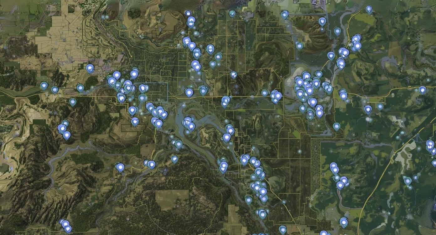
• Full Coverage: We fly GPS guided routes to cover every acre of your property.
• Thermal Accuracy: Our cameras detect bedded animals and allow us to distinguish bucks
from does, even pinpointing trophy class bucks by antler count.
• Low Impact: Our drones fly high and quiet, gathering data without disturbing your herd from above.
Your Deliverables
Every survey comes with a package designed to give you both clarity and confidence:
• A verified herd count with buck to doe ratios
• Predator activity mapped across your property
• Flight path overlays with animal distribution highlights
• 3–5 thermal images featuring standout bucks or unique sightings
• A final reviewed report suitable for MLDP enrollment or county wildlife exemption filings
Seasonal Advantage
Timing is everything. During fawning season, we offer specialized add on surveys that track recruitment and herd growth potential. This extra layer of insight gives landowners a clearer look at how their management efforts are paying off.
Why Landowners Choose Vantage Recon
Our clients aren’t just looking for numbers. They want answers. By putting advanced technology to work on your property, we deliver data that translates directly into smarter harvest plans, stronger habitat strategies, and long term herd health.
This service is ideal for:
• Ranch owners working to improve herd quality
• Lease groups that need transparent, trusted counts
• Hunters who want reliable insight before the season begins
• Properties seeking verified counts for TPWD or appraisal district filings
See Your Property in a New Way
A Vantage Recon survey transforms your land from an unknown into a clear, measurable asset. With every flight, you get actionable data, peace of mind, and a better understanding of the
wildlife you manage.
Reserve your survey today. Monthly availability is limited.