More Than Numbers. Real Locations.
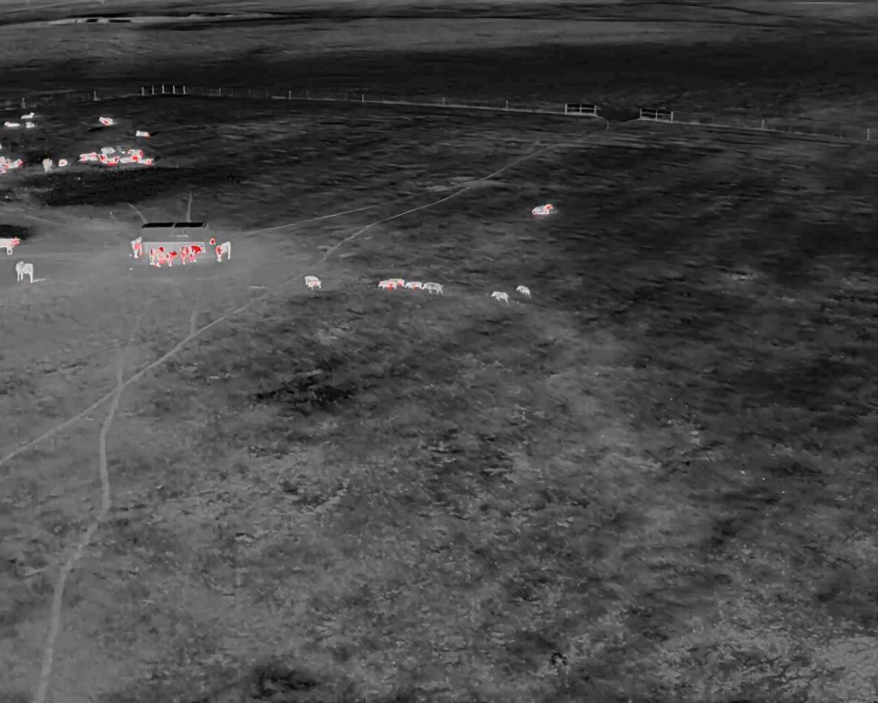
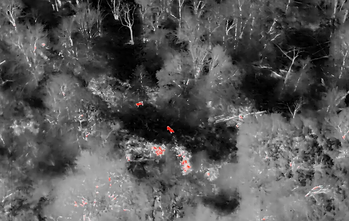
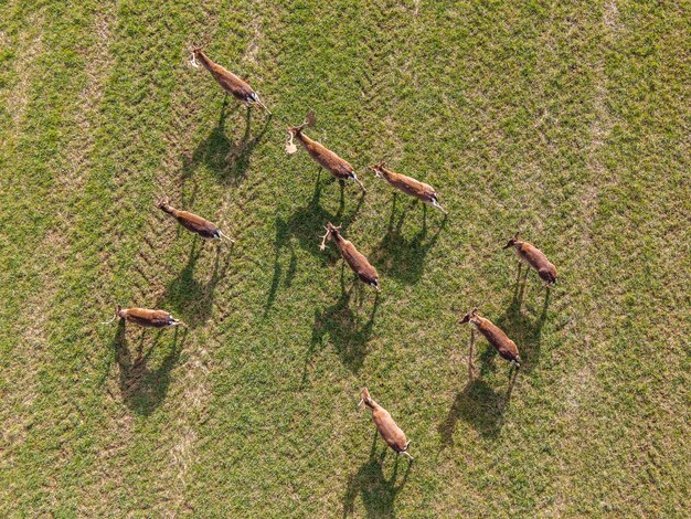
Wildlife Intel Map transforms your herd survey into a powerful visual tool. Instead of just knowing how many animals are on your land, you’ll know exactly where they are. By pairing thermal drone imaging with advanced geospatial mapping, we create a detailed map of wildlife activity across your property.
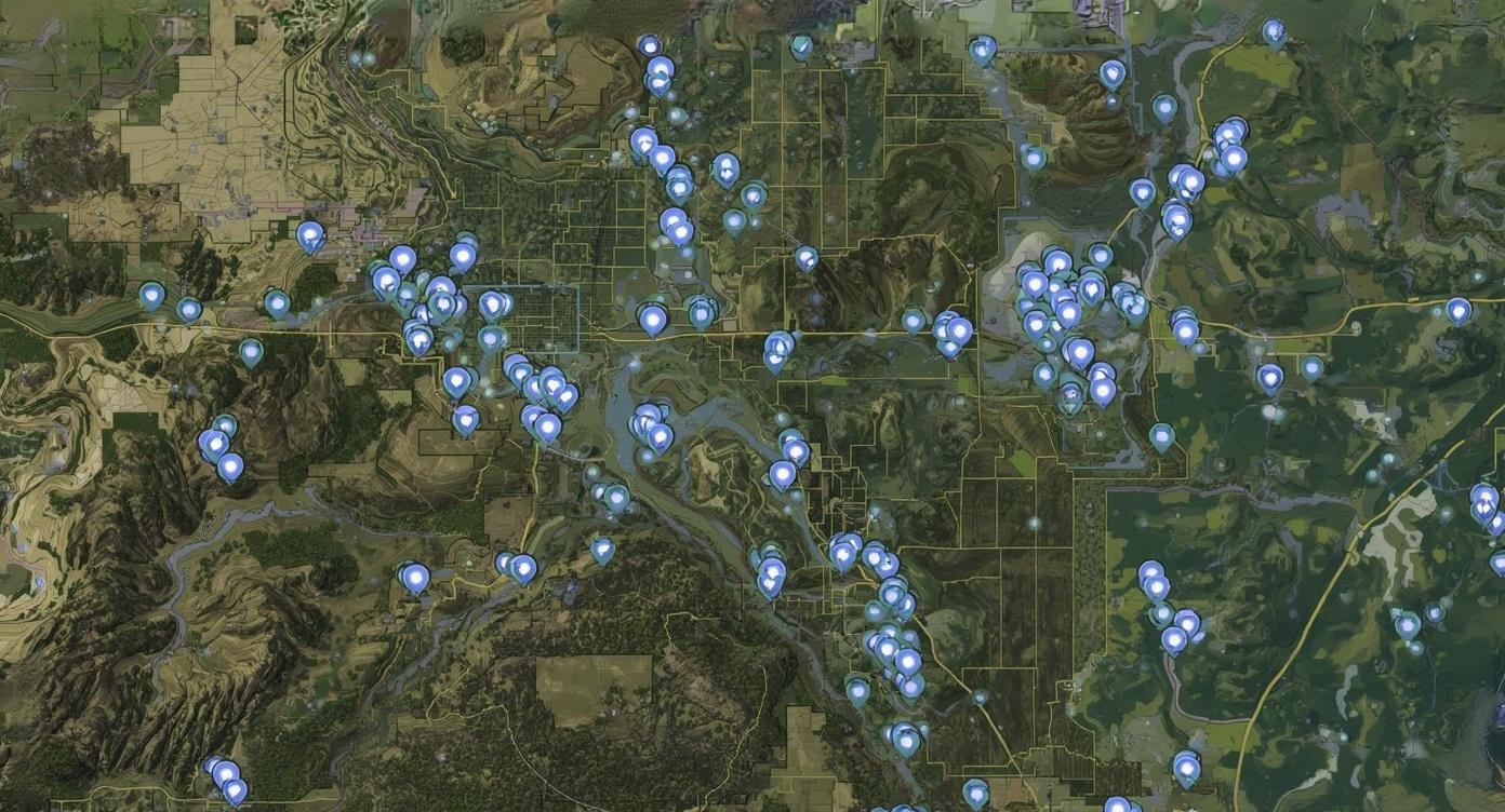
Every animal identified during your survey is tagged and logged by location. These data points are then layered over your property in a map that highlights bedding areas, travel corridors, and zones of high activity.
The result is a clear picture of how deer and other wildlife move across your land, season after season.
Why It Matters
• Hunters can place blinds and stands in the most productive locations
• Landowners can plan new food plots, water sources, and habitat improvements with precision
• Outfitters gain a reliable tool for guiding hunts and managing pressure on herds
• Ranches and conservation properties benefit from a strategic, data driven approach to
management
What You’ll Receive
Your Wildlife Intel Map is delivered in a simple digital format that highlights movement patterns, activity zones, and key hotspots, giving you the confidence to plan improvements and manage your land strategically. You will receive KMZ and GPX files that can be easily imported into your own OnX Maps account, giving you full access to all waypoints directly in the field.
Who It’s For
• Ranch owners who want to maximize the value of every acre
• Hunting leases that need accurate, shared data for all members
• Outfitters looking to give clients the best chance at success
• Properties focused on long term conservation and habitat health
The wildlife intel map gives you more than data. It gives you direction. By visualizing how wildlife uses your property, you can manage smarter, hunt more effectively, and make the most of your land.
Ask about adding a Wildlife Intel Map to your next survey.